| at: |
Lajitas Trails |
Data from David Muse
 show on map
 animate
Trail users:


Elevation Profile
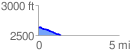
 1.410572 mi
 13.19 ft
 136.85 ft
 -123.67 ft
 1.84 %
GPX Downloads: Track Route
![]()
| at: |
Lajitas Trails |
show on map
animate
1.410572 mi
13.19 ft
136.85 ft
-123.67 ft
1.84 %