| at: |
Harbison State Forest |
Data from Positive Flow
 show on map
 animate
Trail users:


Elevation Profile
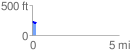
 0.242707 mi
 29.77 ft
 39.58 ft
 -9.81 ft
 3.09 %
GPX Downloads: Track Route
![]()
| at: |
Harbison State Forest |
show on map
animate
0.242707 mi
29.77 ft
39.58 ft
-9.81 ft
3.09 %