| at: |
Tray Mountain |
Data from David Muse
 show on map
 animate
Trail users:

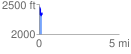
Elevation Profile
 0.186394 mi
 109.71 ft
 163.72 ft
 -54.01 ft
 16.64 %
GPX Downloads: Track Route
![]()
| at: |
Tray Mountain |
show on map
animate
0.186394 mi
109.71 ft
163.72 ft
-54.01 ft
16.64 %