| at: |
Tray Mountain |
Data from David Muse
 show on map
 animate
Trail users:


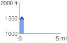
Elevation Profile
 0.521166 mi
 89.71 ft
 88.10 ft
 1.61 ft
 3.26 %
GPX Downloads: Track Route
![]()
| at: |
Tray Mountain |
show on map
animate
0.521166 mi
89.71 ft
88.10 ft
1.61 ft
3.26 %