|
| at: |
Houston Valley |
Data from USFS GIS
 show on map
 animate
Trail users:


Elevation Profile
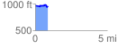
 0.897116 mi
 88.51 ft
 96.38 ft
 -7.87 ft
 2.03 %
GPX Downloads: Track Route
![]()
|
| at: |
Houston Valley |
show on map
animate
0.897116 mi
88.51 ft
96.38 ft
-7.87 ft
2.03 %