|
| at: |
Houston Valley |
Data from USFS GIS
 show on map
 animate
Trail users:


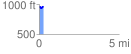
Elevation Profile
 0.282600 mi
 38.25 ft
 38.25 ft
 0.00 ft
 2.56 %
GPX Downloads: Track Route
![]()
|
| at: |
Houston Valley |
show on map
animate
0.282600 mi
38.25 ft
38.25 ft
0.00 ft
2.56 %