|
| at: |
Houston Valley |
Data from USFS GIS
 show on map
 animate
Trail users:


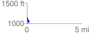
Elevation Profile
 0.224041 mi
 10.87 ft
 110.33 ft
 -99.45 ft
 9.33 %
GPX Downloads: Track Route
![]()
|
| at: |
Houston Valley |
show on map
animate
0.224041 mi
10.87 ft
110.33 ft
-99.45 ft
9.33 %