| at: |
Panther Creek |
Data from USFS GIS
 show on map
 animate
Trail users:

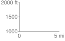
Elevation Profile
 0.019609 mi
 0.38 ft
 2.27 ft
 -1.89 ft
 2.19 %
GPX Downloads: Track Route
![]()
| at: |
Panther Creek |
show on map
animate
0.019609 mi
0.38 ft
2.27 ft
-1.89 ft
2.19 %