| at: |
Rich Mountain |
Data from David Muse
 show on map
 animate
Trail users:


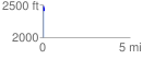
Elevation Profile
 0.078135 mi
 0.00 ft
 80.23 ft
 -80.23 ft
 19.45 %
GPX Downloads: Track Route
![]()
| at: |
Rich Mountain |
show on map
animate
0.078135 mi
0.00 ft
80.23 ft
-80.23 ft
19.45 %