| at: |
South Oconee National Forest |
Data from USFS GIS
 show on map
 animate
USFS GIS data shows this as an inventoried trail, named XXX.
Trail users:
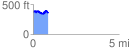
Elevation Profile
 0.887374 mi
 153.33 ft
 145.12 ft
 8.21 ft
 3.27 %
GPX Downloads: Track Route