| at: |
Sandy Ford |
Data from USFS GIS
 show on map
 animate
Trail users:

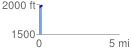
Elevation Profile
 0.173010 mi
 55.91 ft
 26.98 ft
 28.93 ft
 6.12 %
GPX Downloads: Track Route
Trailheads:
 Warwoman Dell Lot
![]()
| at: |
Sandy Ford |
show on map
animate
0.173010 mi
55.91 ft
26.98 ft
28.93 ft
6.12 %
Warwoman Dell Lot