|
| at: |
Whissenhunt/Campbell Mountain |
Data from USFS GIS
 show on map
 animate
Trail users:


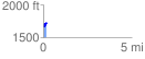
Elevation Profile
 0.172436 mi
 97.37 ft
 69.56 ft
 27.81 ft
 10.69 %
GPX Downloads: Track Route
![]()
|
| at: |
Whissenhunt/Campbell Mountain |
show on map
animate
0.172436 mi
97.37 ft
69.56 ft
27.81 ft
10.69 %