| at: |
Greensboro Watershed Trails |
Data from Positive Flow
 show on map
 animate
Trail users:


Elevation Profile
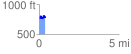
 0.398017 mi
 103.42 ft
 74.23 ft
 29.19 ft
 4.92 %
GPX Downloads: Track Route
![]()
| at: |
Greensboro Watershed Trails |
show on map
animate
0.398017 mi
103.42 ft
74.23 ft
29.19 ft
4.92 %