| at: |
Buffalo Creek |
Data from David Muse
 show on map
 animate
Trail users:


Elevation Profile
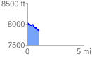
 1.023811 mi
 31.51 ft
 231.79 ft
 -200.28 ft
 4.29 %
GPX Downloads: Track Route
Trailheads:
 Buck Gulch
![]()
| at: |
Buffalo Creek |
show on map
animate
1.023811 mi
31.51 ft
231.79 ft
-200.28 ft
4.29 %
Buck Gulch