| at: |
Santos |
Data from USFS GIS
 show on map
 animate
Trail users:


Elevation Profile
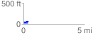
 0.385833 mi
 25.69 ft
 22.93 ft
 2.76 ft
 1.26 %
GPX Downloads: Track Route
![]()
| at: |
Santos |
show on map
animate
0.385833 mi
25.69 ft
22.93 ft
2.76 ft
1.26 %