| at: |
Santos |
Data from USFS GIS
 show on map
 animate
Trail users:


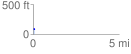
Elevation Profile
 0.090391 mi
 15.29 ft
 16.51 ft
 -1.22 ft
 3.46 %
GPX Downloads: Track Route
![]()
| at: |
Santos |
show on map
animate
0.090391 mi
15.29 ft
16.51 ft
-1.22 ft
3.46 %