| at: |
Santos |
Data from USFS GIS
 show on map
 animate
Trail users:


Elevation Profile
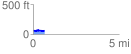
 0.692851 mi
 25.62 ft
 29.93 ft
 -4.31 ft
 0.82 %
GPX Downloads: Track Route
![]()
| at: |
Santos |
show on map
animate
0.692851 mi
25.62 ft
29.93 ft
-4.31 ft
0.82 %