| at: |
Santos |
Data from USFS GIS
 show on map
 animate
Trail users:


Elevation Profile
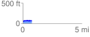
 0.775383 mi
 42.22 ft
 31.74 ft
 10.48 ft
 1.03 %
GPX Downloads: Track Route
![]()
| at: |
Santos |
show on map
animate
0.775383 mi
42.22 ft
31.74 ft
10.48 ft
1.03 %