| at: |
Santos |
Data from USFS GIS
 show on map
 animate
Trail users:


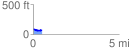
Elevation Profile
 0.524555 mi
 19.21 ft
 35.56 ft
 -16.34 ft
 1.28 %
GPX Downloads: Track Route
![]()
| at: |
Santos |
show on map
animate
0.524555 mi
19.21 ft
35.56 ft
-16.34 ft
1.28 %