| at: |
Santos |
Data from USFS GIS
 show on map
 animate
Trail users:


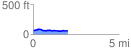
Elevation Profile
 2.058618 mi
 122.91 ft
 122.91 ft
 0.00 ft
 1.13 %
GPX Downloads: Track Route
![]()
| at: |
Santos |
show on map
animate
2.058618 mi
122.91 ft
122.91 ft
0.00 ft
1.13 %