| at: |
Kennesaw Mountain National Battlefield Park |
Data from National Parks Service
 show on map
 animate
Trail users:

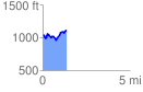
Elevation Profile
 1.391115 mi
 258.32 ft
 182.23 ft
 76.09 ft
 3.52 %
GPX Downloads: Track Route
![]()
| at: |
Kennesaw Mountain National Battlefield Park |
show on map
animate
1.391115 mi
258.32 ft
182.23 ft
76.09 ft
3.52 %