| at: |
Snow Basin Recreation Area |
Data from Jason Sager
 show on map
 animate
Trail users:


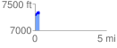
Elevation Profile
 0.300713 mi
 134.67 ft
 97.00 ft
 37.67 ft
 8.48 %
GPX Downloads: Track Route
![]()
| at: |
Snow Basin Recreation Area |
show on map
animate
0.300713 mi
134.67 ft
97.00 ft
37.67 ft
8.48 %