| in: |
Southern Oregon |
near: |
Ashland,
Oregon |
 show on map
 printable map
Last Trail Update: 2010-04-29
printable map
Last Trail Update: 2010-04-29Maps:
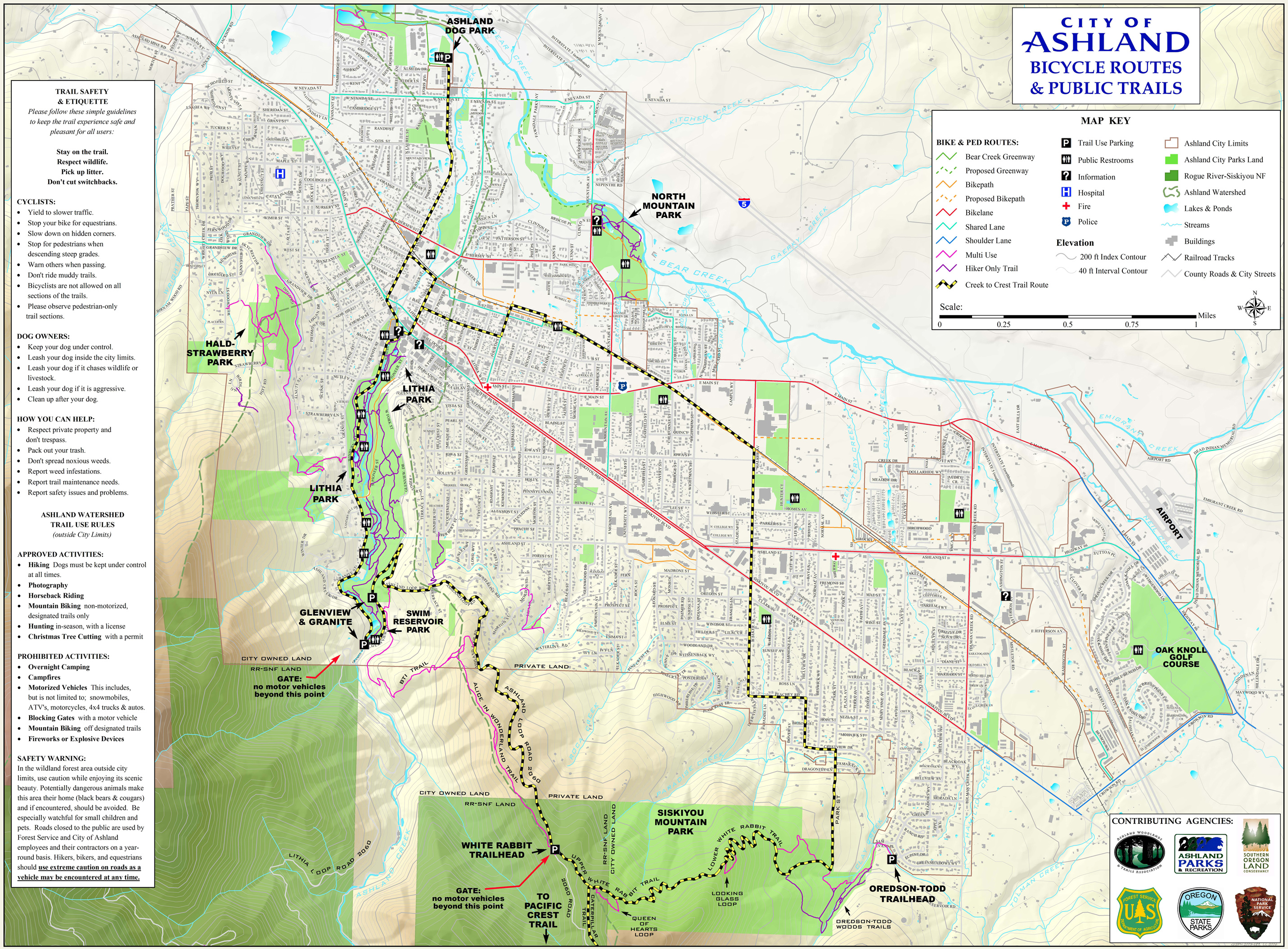
Links:
The Ashland Woodlands and Trails Association
Total Mileage: (note)
 Bike Trail - 3.70 mi Dirt/Gravel Road - 4.04 mi
Trails:
Alice in Wonderland Trail - 0.85 mi BTI Trail - 0.69 mi BTI Trail (Unexplored) - 0.22 mi Catwalk Connector - 0.33 mi Catwalk Trail - 0.99 mi Toothpick Trail - 0.62 mi Roads:
Ashland Loop Road (Unpaved) - 1.13 mi | AKA: |
Road 2060 |
Ashland Loop Road (Unpaved, Closed to Vehicles) - 2.82 mi | AKA: |
Road 2060 |
Road 100 - 0.09 mi Ashland Loop Road (Paved) - 0.73 mi | AKA: |
Road 2060 |
Glenview Drive - 0.49 mi Granite Road - 1.21 mi