|
| in: |
Clemson Area |
near: |
Clemson,
South Carolina |
 show on map
 printable map
Last Trail Update: 2011-09-16
printable map
Last Trail Update: 2011-09-16Maps:

Links:
Clemson Experimental Forest Map
Trailheads:
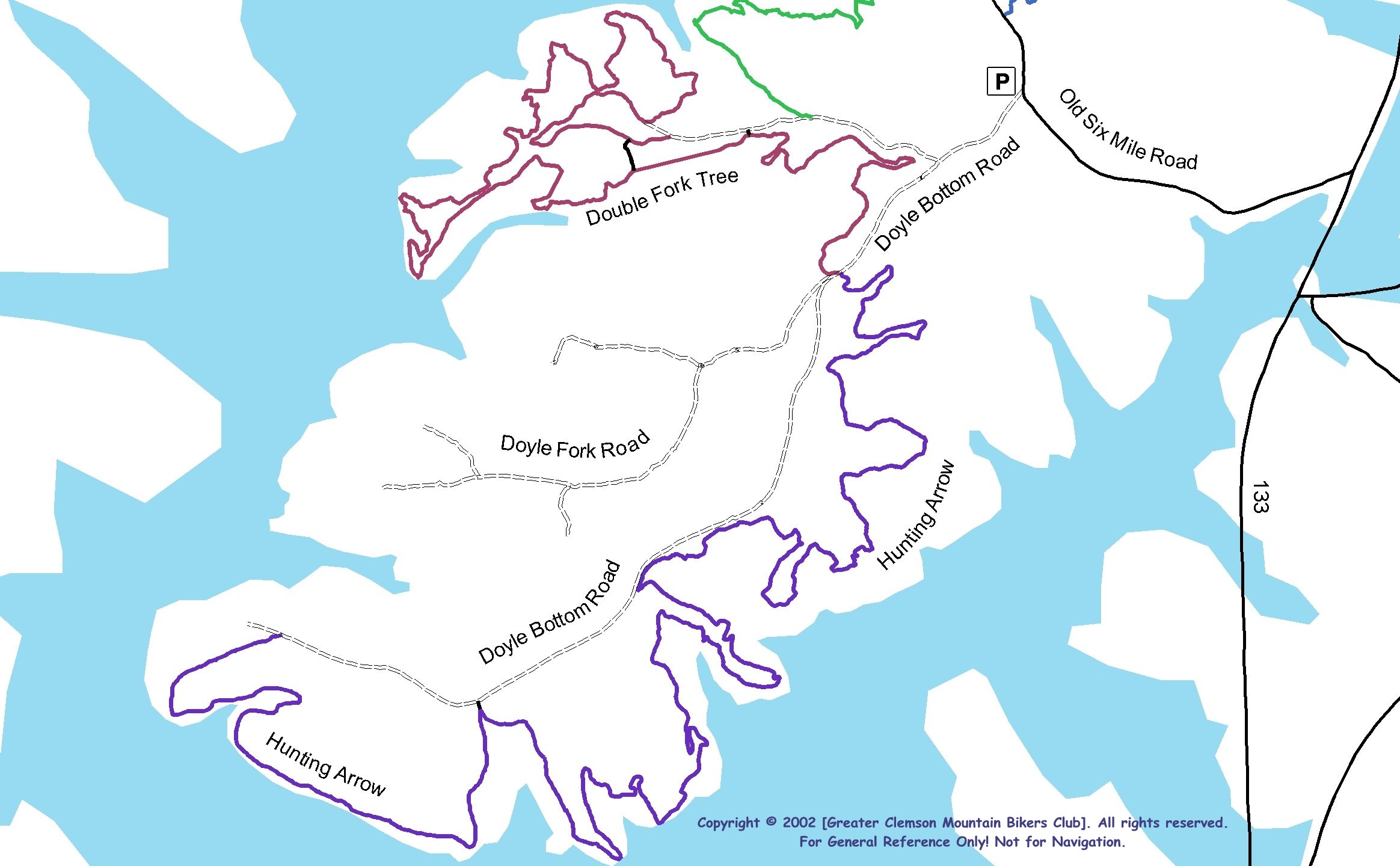
 Doyle Bottom Area Lot
Total Mileage: (note)
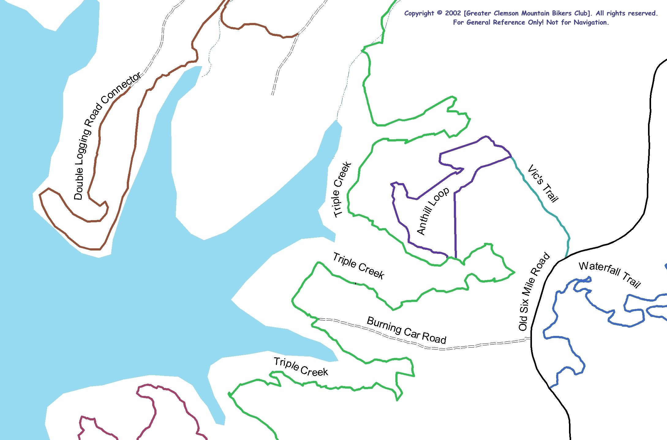
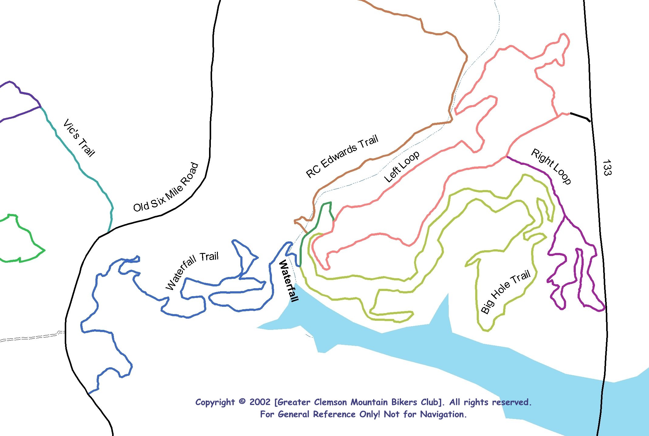
 Bike/Horse Trail - 17.33 mi Dirt/Gravel Road - 2.44 mi Unmaintained Road - 0.86 mi
Trails:
Anthill Loop - 0.64 mi Big Hole Trail - 1.37 mi Black Trail - 0.17 mi Double Fork Tree (Section 1) - 0.25 mi Double Fork Tree (Section 2, Unexplored) - 0.25 mi Double Fork Tree (Section 3) - 2.57 mi Green Trail - 0.04 mi Hunting Arrow Trail - 4.72 mi Left Loop - 1.02 mi R.C. Edwards Trail - 1.33 mi Right Loop - 0.50 mi Triple Creek Descent - 0.12 mi Triple Creek Descent (Unexplored) - 0.13 mi Triple Creek Trail - 2.18 mi Unknown Trail - 1.01 mi Vics Trail - 0.16 mi Waterfall Trail - 0.86 mi Roads:
Burning Car Road - 0.31 mi Double Fork Tree (Old Roadbed) - 0.46 mi Doyle Bottom Road - 1.67 mi Logging Road No. 1 - 0.86 mi Old Six Mile Road - 1.75 mi