|
| at: |
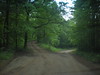
Blue Ridge WMA Bull/Jake Mountain |
Data from David Muse
 show on map
 animate
Trail users:


Elevation Profile
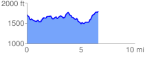
 6.767705 mi
 966.31 ft
 874.69 ft
 91.62 ft
 2.70 %
GPX Downloads: Track Route
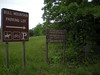
Trailheads:
 Camp Wahsega Parking LotOld Blue Ridge WMA Game Check Station Lot