|
| at: |
Sumter National Forest - Long Cane District Cedar Springs OHV Trail |
Data from USFS GIS
 show on map
 animate
Trail users:


Elevation Profile
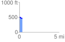
 0.381956 mi
 10.91 ft
 53.32 ft
 -42.41 ft
 2.64 %
GPX Downloads: Track Route
![]()
|
| at: |
Sumter National Forest - Long Cane District Cedar Springs OHV Trail |
show on map
animate
0.381956 mi
10.91 ft
53.32 ft
-42.41 ft
2.64 %