|
| at: |
Sumter National Forest - Long Cane District |
Data from USFS GIS
 show on map
 animate
Trail users:


Elevation Profile
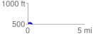
 0.389824 mi
 24.01 ft
 67.72 ft
 -43.71 ft
 3.29 %
GPX Downloads: Track Route
![]()
|
| at: |
Sumter National Forest - Long Cane District |
show on map
animate
0.389824 mi
24.01 ft
67.72 ft
-43.71 ft
3.29 %