|
| at: |
Sumter National Forest - Long Cane District Cedar Springs OHV Trail |
Data from USFS GIS
 show on map
 animate
Trail users:


Elevation Profile
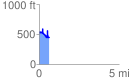
 0.632623 mi
 409.57 ft
 506.60 ft
 -97.02 ft
 15.17 %
GPX Downloads: Track Route