|
| at: |
Sumter National Forest - Long Cane District |
Data from USFS GIS
 show on map
 animate
Trail users:


Elevation Profile
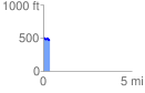
 0.364772 mi
 17.69 ft
 62.15 ft
 -44.46 ft
 3.23 %
GPX Downloads: Track Route
![]()
|
| at: |
Sumter National Forest - Long Cane District |
show on map
animate
0.364772 mi
17.69 ft
62.15 ft
-44.46 ft
3.23 %