|
| at: |
Conecuh National Forest |
Data from USFS GIS
 show on map
 animate
Trail users:


Elevation Profile
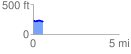
 0.583494 mi
 17.37 ft
 32.84 ft
 -15.47 ft
 1.07 %
GPX Downloads: Track Route
![]()
|
| at: |
Conecuh National Forest |
show on map
animate
0.583494 mi
17.37 ft
32.84 ft
-15.47 ft
1.07 %