| at: |
Holly Springs National Forest - North |
Data from USFS GIS
 show on map
 animate
Trail users:


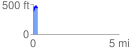
Elevation Profile
 0.263464 mi
 98.20 ft
 25.21 ft
 72.99 ft
 7.06 %
GPX Downloads: Track Route
![]()
| at: |
Holly Springs National Forest - North |
show on map
animate
0.263464 mi
98.20 ft
25.21 ft
72.99 ft
7.06 %