|
| at: |
Bienville National Forest |
Data from USFS GIS
 show on map
 animate
Trail users:


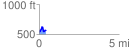
Elevation Profile
 0.441811 mi
 96.60 ft
 84.16 ft
 12.44 ft
 4.14 %
GPX Downloads: Track Route
![]()
|
| at: |
Bienville National Forest |
show on map
animate
0.441811 mi
96.60 ft
84.16 ft
12.44 ft
4.14 %