|
| at: |
Bienville National Forest |
Data from USFS GIS
 show on map
 animate
Trail users:


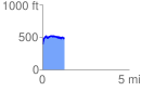
Elevation Profile
 1.253822 mi
 257.68 ft
 160.44 ft
 97.24 ft
 3.89 %
GPX Downloads: Track Route
![]()
|
| at: |
Bienville National Forest |
show on map
animate
1.253822 mi
257.68 ft
160.44 ft
97.24 ft
3.89 %