|
| at: |
Bienville National Forest |
Data from USFS GIS
 show on map
 animate
Trail users:


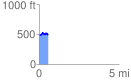
Elevation Profile
 0.585533 mi
 77.84 ft
 60.74 ft
 17.10 ft
 2.52 %
GPX Downloads: Track Route
![]()
|
| at: |
Bienville National Forest |
show on map
animate
0.585533 mi
77.84 ft
60.74 ft
17.10 ft
2.52 %