|
| at: |
Bienville National Forest |
Data from USFS GIS
 show on map
 animate
Trail users:


Elevation Profile
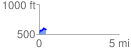
 0.437526 mi
 88.71 ft
 38.80 ft
 49.91 ft
 3.84 %
GPX Downloads: Track Route
![]()
|
| at: |
Bienville National Forest |
show on map
animate
0.437526 mi
88.71 ft
38.80 ft
49.91 ft
3.84 %