| at: |
Bienville National Forest |
Data from USFS GIS
 show on map
 animate
Trail users:


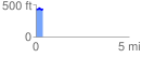
Elevation Profile
 0.356879 mi
 53.57 ft
 36.11 ft
 17.46 ft
 2.84 %
GPX Downloads: Track Route
![]()
| at: |
Bienville National Forest |
show on map
animate
0.356879 mi
53.57 ft
36.11 ft
17.46 ft
2.84 %