| at: |
Bienville National Forest |
Data from USFS GIS
 show on map
 animate
Trail users:


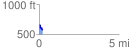
Elevation Profile
 0.214926 mi
 7.62 ft
 91.41 ft
 -83.79 ft
 8.05 %
GPX Downloads: Track Route
![]()
| at: |
Bienville National Forest |
show on map
animate
0.214926 mi
7.62 ft
91.41 ft
-83.79 ft
8.05 %