| at: |
Bienville National Forest |
Data from USFS GIS
 show on map
 animate
Trail users:


Elevation Profile
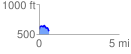
 0.634129 mi
 85.75 ft
 114.34 ft
 -28.59 ft
 3.41 %
GPX Downloads: Track Route
![]()
| at: |
Bienville National Forest |
show on map
animate
0.634129 mi
85.75 ft
114.34 ft
-28.59 ft
3.41 %