| at: |
Kisatchie National Forest - Caney District |
Data from USFS GIS
 show on map
 animate
Trail users:


Elevation Profile
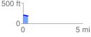
 0.442478 mi
 9.97 ft
 27.86 ft
 -17.89 ft
 1.19 %
GPX Downloads: Track Route
![]()
| at: |
Kisatchie National Forest - Caney District |
show on map
animate
0.442478 mi
9.97 ft
27.86 ft
-17.89 ft
1.19 %