| at: |
Kisatchie National Forest - Kisatchie District |
Data from USFS GIS
 show on map
 animate
Trail users:


Elevation Profile
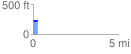
 0.265981 mi
 19.24 ft
 8.97 ft
 10.27 ft
 1.37 %
GPX Downloads: Track Route
![]()
| at: |
Kisatchie National Forest - Kisatchie District |
show on map
animate
0.265981 mi
19.24 ft
8.97 ft
10.27 ft
1.37 %