| at: |
Kisatchie National Forest - Kisatchie District |
Data from USFS GIS
 show on map
 animate
Trail users:


Elevation Profile
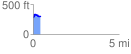
 0.423347 mi
 58.20 ft
 54.82 ft
 3.38 ft
 2.60 %
GPX Downloads: Track Route
![]()
| at: |
Kisatchie National Forest - Kisatchie District |
show on map
animate
0.423347 mi
58.20 ft
54.82 ft
3.38 ft
2.60 %