|
| at: |
Wolf Creek Area |
Data from David Muse
 show on map
 animate
USFS GIS data shows a small chunk of this road as FS218T. The road crosses onto and off of USFS land several times.
Trail users:


Elevation Profile
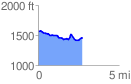
 2.744913 mi
 192.46 ft
 315.05 ft
 -122.59 ft
 2.17 %
GPX Downloads: Track Route