| at: |
Sumter National Forest - Enoree District Enoree OHV Trail |
Data from USFS GIS
 show on map
 animate
Trail users:


Elevation Profile
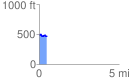
 0.493686 mi
 37.56 ft
 65.84 ft
 -28.28 ft
 2.53 %
GPX Downloads: Track Route
![]()
| at: |
Sumter National Forest - Enoree District Enoree OHV Trail |
show on map
animate
0.493686 mi
37.56 ft
65.84 ft
-28.28 ft
2.53 %