| at: |
Sumter National Forest - Enoree District Enoree OHV Trail |
Data from USFS GIS
 show on map
 animate
Trail users:


Elevation Profile
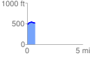
 0.745465 mi
 73.79 ft
 60.52 ft
 13.27 ft
 1.87 %
GPX Downloads: Track Route
![]()
| at: |
Sumter National Forest - Enoree District Enoree OHV Trail |
show on map
animate
0.745465 mi
73.79 ft
60.52 ft
13.27 ft
1.87 %