| at: |
Sumter National Forest - Long Cane District Cedar Springs OHV Trail |
Data from USFS GIS
 show on map
 animate
Trail users:


Elevation Profile
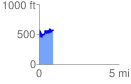
 0.880021 mi
 360.70 ft
 367.38 ft
 -6.68 ft
 7.91 %
GPX Downloads: Track Route
![]()
| at: |
Sumter National Forest - Long Cane District Cedar Springs OHV Trail |
show on map
animate
0.880021 mi
360.70 ft
367.38 ft
-6.68 ft
7.91 %