| at: |
Sumter National Forest - Long Cane District Modoc and Wine/Turkey Creek |
Data from USFS GIS
 show on map
 animate
Trail users:


Elevation Profile
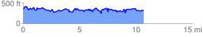
 10.821254 mi
 3177.49 ft
 3229.92 ft
 -52.43 ft
 5.65 %
GPX Downloads: Track Route
Trailheads:
 Key Bridge/Prices BottomWine/Turkey Creek Lot