| at: |
Northeast Texas Trail |
Data from David Muse
 show on map
 animate
This road is alleged to be a county road on maps, but in the field, at least as of 2020, it is gated at a point (though the gate was open), and eventually has an electric fence strung across it.
Trail users:


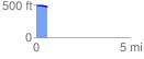
Elevation Profile
 0.594968 mi
 0.98 ft
 29.76 ft
 -28.77 ft
 0.95 %
GPX Downloads: Track Route