| at: |
Dawson Forest |
Data from David Muse
 show on map
 animate
This was once a railway leading from the end of Dawson Forest Road to the Dawson Forest parking area. The tracks have been ripped up and it has been turned into a road.
Trail users:


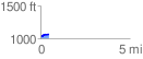
Elevation Profile
 0.488117 mi
 55.14 ft
 17.38 ft
 37.76 ft
 2.14 %
GPX Downloads: Track Route