|
| at: |
Morganton Point Recreation Area |
Data from David Muse
 show on map
 animate
Trail users:


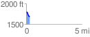
Elevation Profile
 0.317134 mi
 0.00 ft
 122.18 ft
 -122.18 ft
 7.30 %
GPX Downloads: Track Route
![]()
|
| at: |
Morganton Point Recreation Area |
show on map
animate
0.317134 mi
0.00 ft
122.18 ft
-122.18 ft
7.30 %