|
| at: |
Morganton Point Recreation Area |
Data from David Muse
 show on map
 animate
Trail users:


Elevation Profile
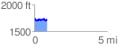
 0.859847 mi
 127.21 ft
 133.07 ft
 -5.86 ft
 2.93 %
GPX Downloads: Track Route
![]()
|
| at: |
Morganton Point Recreation Area |
show on map
animate
0.859847 mi
127.21 ft
133.07 ft
-5.86 ft
2.93 %